We headed to the Lost Coast area of Northern California. Apparently, the hills in the area were too difficult to construct Highway 1 through so they just skipped an entire section leaving a a huge area of untouched land along the Pacific Coast. We went in March. This was definitely the wrong time to visit if you don't like rain. It basically rained the entire time which made fire starting rather difficult. We parked at a free parking site on the water just above the trail head on the north side of town. The hike can be as long as you would like as you can hike North up to the next town about 10-12 miles away. Don't be fooled, hiking on a beach is very different exhausting your body much quicker. You also have to cross small streams throughout your hike. Be ready to take your shoes off. Time your crossing right because you could be hit by an incoming wave. If you do plan to hike through, make sure you know the tides. A section in the middle of the hike is not crossable during high tide. People have been swept out to sea and even died on this part of the hike. About two miles in, you will find a nice little camp site where logs are piled up for shelter from the wind. Since we didn't come prepared for the tides, we decided to stop here for the night. Even in the summer, you can get rained on so come prepared and come with a lot of rain gear and fire starting material if you plan to camp.
My blog is intended to be an informative guide for hiking and backpacking. While books and official sites are helpful, I am always left with a sense of uncertainty about the adventure. I figured it would be helpful to have a little more qualitative data and some pictures to help inform your choices. I also hope to share my adventures with friends and family who wonder what I do with my time. Suggestions on places to hike or what to include in my blog would be much appreciated! Enjoy!
Friday, July 20, 2012
Lost Coast- Shelter Cove, CA
We headed to the Lost Coast area of Northern California. Apparently, the hills in the area were too difficult to construct Highway 1 through so they just skipped an entire section leaving a a huge area of untouched land along the Pacific Coast. We went in March. This was definitely the wrong time to visit if you don't like rain. It basically rained the entire time which made fire starting rather difficult. We parked at a free parking site on the water just above the trail head on the north side of town. The hike can be as long as you would like as you can hike North up to the next town about 10-12 miles away. Don't be fooled, hiking on a beach is very different exhausting your body much quicker. You also have to cross small streams throughout your hike. Be ready to take your shoes off. Time your crossing right because you could be hit by an incoming wave. If you do plan to hike through, make sure you know the tides. A section in the middle of the hike is not crossable during high tide. People have been swept out to sea and even died on this part of the hike. About two miles in, you will find a nice little camp site where logs are piled up for shelter from the wind. Since we didn't come prepared for the tides, we decided to stop here for the night. Even in the summer, you can get rained on so come prepared and come with a lot of rain gear and fire starting material if you plan to camp.
Wednesday, July 18, 2012
Bryce Canyon- Figure 8 including Peekaboo and Navajo Trails- Utah
Bryce Canyon is around 8000
ft. so be prepared to be out of breath. The figure 8 loop combines multiple mini hikes into one longer 8.5ish hike. You can do the views and picture taking
from a drive that allows you to see down into the canyon from many different
perspectives. There are a bunch of hikes you can put together into a figure
eight pattern down in the canyon that will let you see much of the cool hoodoo’s,
red dirt, and more red dirt. The path is well marked and wide. Watch out for
the horse crap that covers half the trail. Someone needs to invent a pooper
scooper for horses because it was everywhere. Very unique environment,
beautiful colors (make sure to stay and watch the sunset with golden colors
bouncing of the distant rocks). There are many opportunities to cut your hike
short or just keep going for more hoodoo’s, views, and red dirt. Like Zion,
more people speaking foreign languages around you, but not as packed as some
hikes. Definitely worth it if you around this area. We stayed in a nearby campsite that was literally 10-20 yards from the edge of the canyon. Showers and food within walking distance.
Zion- East Plateau Trail- Utah
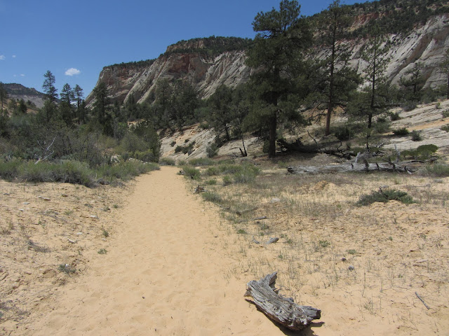
The North East section of Zion that you can drive to near the other entrance is much less traveled. We did not run into one person on this hike. We got the creepies a few times feeling like a Cougar was going to jump out. On our way up we did see a few big horned Ram of some sort. Felt like the trail could go on for miles. The parking lot is just before you exit Zion on the left. There is a dirt parking lot you can drive and park at. Easy trail with sand and dirt. You are up out of the Canyon and have slightly different views around you consisting of unique rock formations, pines, and small brush. Not much water here at least in the summer. All the creeks were dry so make sure to pack in your water!
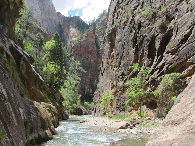
Zion- The Narrows- Utah
Zion- Angels Landing- Utah- 5 miles
Angels Landing in Zion is a relatively easy hike with a clean path... until you get to the last half mile to the top. This is not for you if you don't like heights. As you can tell from the pictures, both sides of the last .5 miles is a sheer vertical drop of over 1000 ft. (I think). Many people get to this point and decide the view is better than the rest of the hike. It can get pretty congested on this part as well with tons of hikers from all over the world. There are chains to grab onto for much of the hike, but the drop on both sides of you can mess with your head. The views at the top are breathtaking and worth it! Bring a lunch and enjoy the view at the top. There are other trails on the back side that aren't as intense if you want a longer hike with more ground underneath your feet. For some reason, the hike reminds me of Half Dome (minus the distance).
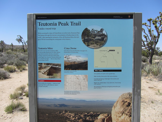
Teutonia Peak Trail- Cima, CA - 3 miles
This hike is definitely in the middle of nowhere. Near the California/Nevada border just off of Cima road near Cima in Southern California (Mojave Desert). About 15 miles of Cima road (watch out for the Tortoises!) you will find the trail head on the right. It is an easy, dry, and hot hike. Very easy. Watch out, we ran into a decent sized rattler sun bathing, definitely got pissed rattled at us and slithered away. If you happen to be in the area or are passing through, it is a great short hike with a beautiful view as a reward at the end. Very few visitors so you will most likely get the place to yourself. Classic desert landscape with cacti, Joshua trees, and many other yuka type plants. To top it off, there is a great little camping site basically across the road where you can have some privacy, protection from the wind, and its free!
Subscribe to:
Posts (Atom)


